
WASHINGTON, Aug. 1 (DC Times Online) — The National Hurricane Center’s Aug. 1 Tropical Weather Outlook called for no tropical activity in the Atlantic, Caribbean or Gulf of Mexico during the following seven days. People in the United States should still check the center’s outlook regularly, especially if they have travel or coastal plans, because a quiet week does not end the hurricane season.
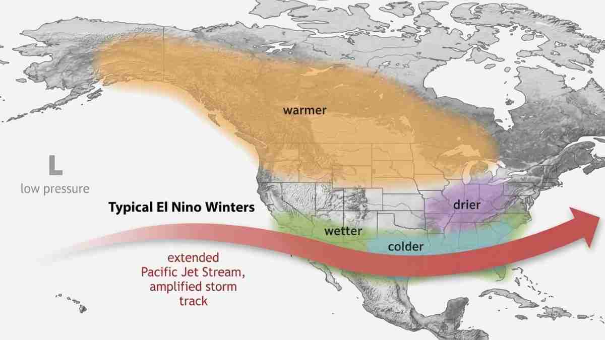
The calm comes as El Niño strengthens across the Pacific. The climate pattern is sending stronger winds into the upper atmosphere over the tropical Atlantic, creating wind shear that can tear apart developing thunderstorms before they become organized storms.
As of July 31, the FOX Forecast Center said the Atlantic season had produced two named storms, one in June and one in July. That pace was below the seasonal forecasts issued by NOAA, Colorado State University and AccuWeather, although those forecasts describe the entire season rather than activity by a particular date.
Why El Niño matters
El Niño is a recurring climate pattern in which unusually warm water develops in the central and eastern tropical Pacific Ocean. Its effects can reach other parts of the atmosphere, including the Atlantic basin.
For Atlantic hurricanes, one important effect is increased wind shear. Wind shear means a change in wind speed or direction with height. Tropical storms need thunderstorms to remain stacked over a circulation near the surface. Strong shear can tilt or disrupt that circulation, making development less likely.
NOAA’s Climate Prediction Center and other forecasters said El Niño was strengthening faster than earlier expected. Forecast discussions described the event as potentially among the strongest since 1950, but the supplied official material does not establish that it will set a record.
What is happening near Africa?
Several tropical waves were moving west from the African coast into the Atlantic’s Main Development Region, the area between the west coast of Africa and the Caribbean where many long-track hurricanes form.
A tropical wave is a broad area of unsettled weather moving through the tropics. Most waves do not become storms. Their chances depend on several conditions working together: warm ocean water, enough moisture and thunderstorms, and weak enough winds aloft.
The FOX Forecast Center said warm Atlantic water could support development, but that influence was being offset by El Niño-related wind shear. Saharan dust and dry, stable air were also limiting thunderstorms across parts of the tropical Atlantic. Dust from Africa can make the atmosphere less favorable for the deep clouds that help tropical systems organize.
The National Hurricane Center’s seven-day outlook listed no areas of interest in its Aug. 1 report. That means forecasters were not identifying a tropical disturbance with a meaningful chance of becoming a depression or storm during that period.
Does a slow start mean a safe season?
No. Seasonal forecasts are broad estimates, not a schedule. A season can begin quietly and still become active later if wind patterns change, dust decreases or tropical waves encounter more favorable conditions.
NOAA was reported as forecasting 8 to 14 named storms, three to six hurricanes and one to three major hurricanes. Colorado State University’s forecast called for 11 named storms, five hurricanes and two major hurricanes. AccuWeather’s forecast called for 8 to 14 named storms, four to seven hurricanes and two to four major hurricanes.
Those forecasts differ because seasonal hurricane prediction involves several uncertain factors, including El Niño’s eventual strength, Atlantic water temperatures and the atmospheric patterns that develop during the peak months.
For residents along the Southeast coast, the Gulf Coast and other areas exposed to Atlantic or Gulf storms, the practical message is simple: There was no immediate tropical threat in the Aug. 1 outlook, but preparation should not wait for a storm to form. Check the National Hurricane Center during the season, know whether a home or workplace is in an evacuation zone, and keep basic supplies and important documents ready.
The current tropical waves may weaken, or one could become more organized if conditions improve. Until then, forecasters are watching the competing effects of warm water, strengthening El Niño, wind shear and Saharan dust.
